Web apps · In progress
LightKit
Light, weather and exposure for drone pilots and photographers
Golden hour, blue hour, wind, clouds and the right ND filter: a planner for the evening before at the desk and for the moment before take-off in the field.
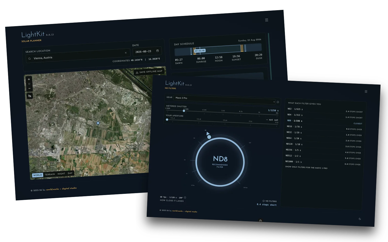
The moment
How do scattered field observations become one calm decision shortly before take-off — fly, wait, or change the plan?
The idea
Choose a place and a date. LightKit shows sunrise, sunset, twilight and the light windows on a map with world, terrain, day and night layers. Wind arrows come from Open-Meteo without any key; a forecast can be added with a free OpenWeatherMap key. An ND-filter calculator turns the metered exposure and the intended frame rate into the filter to fit.
Why it holds
Data is not laid out as a dashboard but translated into flyability indicators and concrete choices. Every tool has its own address, to be bookmarked and shared. Map tiles can be kept for offline use.
The tools
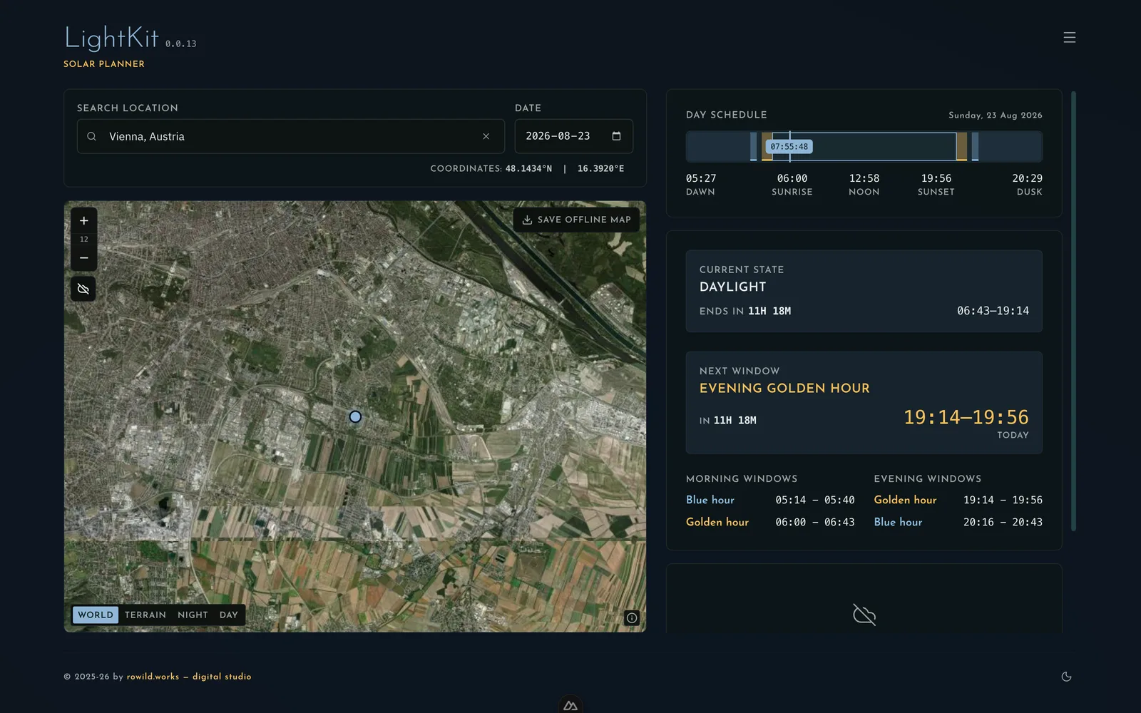
Solar Planner
Light windows and sun position for a place and a day, on a map with weather.
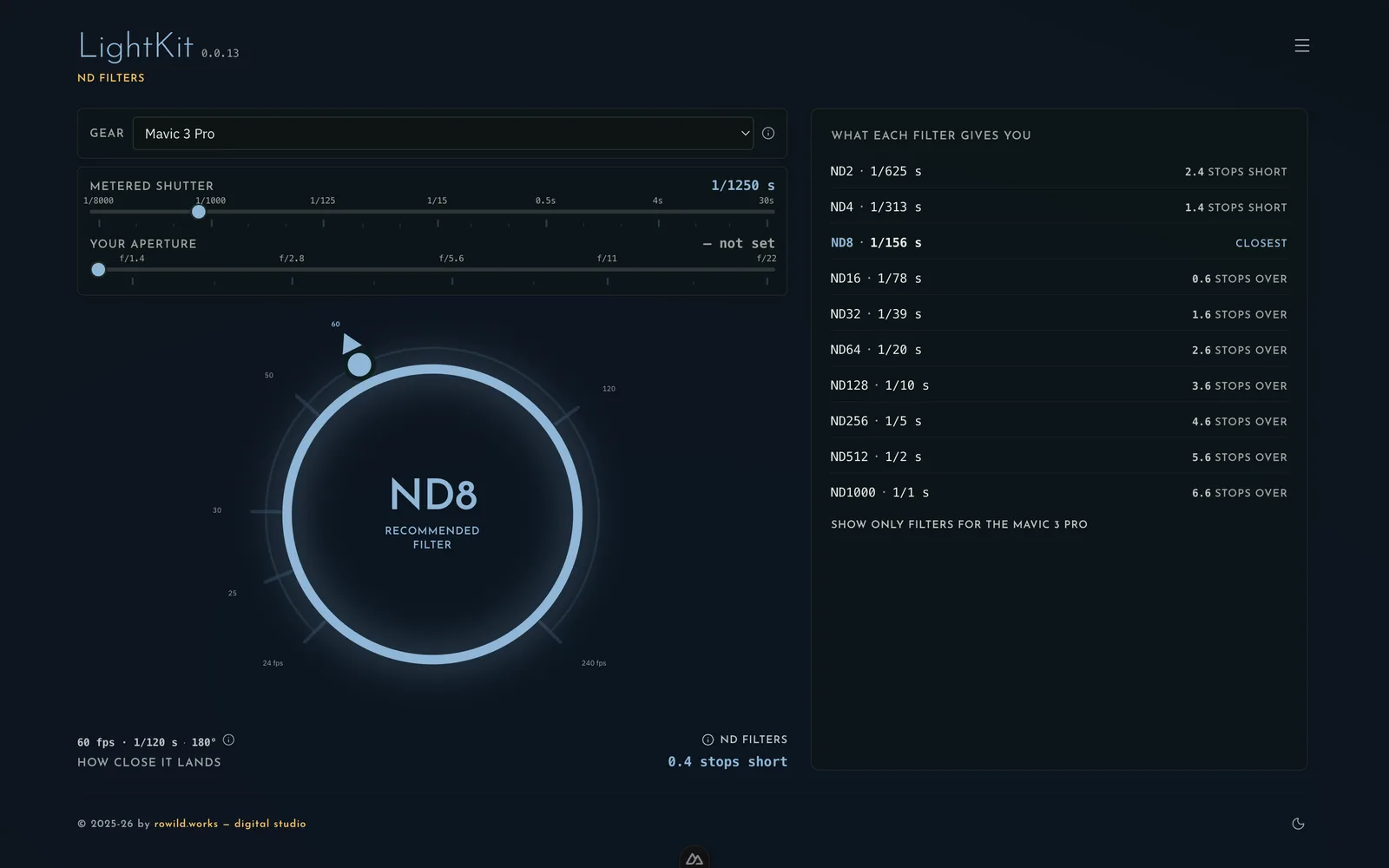
ND Filters
The right filter from exposure, aperture and frame rate.
What you can do with it
- Pick a place and a date and see the day unfold: twilight, blue and golden hour, sunrise and sunset.
- Switch the map between world, terrain, day and night and save areas for offline use.
- Read wind from Open-Meteo without any key; add a forecast with your own OpenWeatherMap key.
- Turn metered exposure, aperture and frame rate into the right ND filter – and see how close it lands.
- Choose aircraft and cameras from a gear list with documented sources.
- Bookmark and share every tool under its own address.
Good to know
- Nuxt 4, OpenLayers, SunCalc
- Gear list of aircraft and camera bodies with sources
- Light, dark and system modes; installable
- PWA
- Nuxt 4
- OpenLayers
- Weather
Part
Product concept, interface, solar and weather integration, gear database with cited sources, the PWA development.